Notes on the Origins and Locations of Place Names
Newcastle - Lake Macquarie - Hunter Valley
C
Cabbage Tree Island (Port Stephens) Named so because it is covered cabbage tree palms.
Cabbage Tree Bay - also once covered in cabbage tree palms situated at Norah Head
Cabbage Tree Flats - Stockton
Cabbage Tree - Re-named Williamtown after William Snodgrass, son of Col. Snodgrass
Caderidia Farm - Allyn River
Caergwrle - After a place in Flint, near Gresford, Wales. Estate of William Boydell
Cairnsmore - Grant to Crawford Logan Brown at Paterson River
Caledonia - N. E. Cessnock - named after a place in Scotland [46]
Calder - W. Gloucester - named after Calder Abbey in Cumberland, England [46]
Calga - S. W. Gosford - indigenous meaning - a stony ridge
Calingorady - A creek in district Liverpool Plains; a branch of the Peel River
Callaghan Swamp - George Hall's run
Calala Cottage - Tamworth. Built 1875
Calore Mount. Co. Northumberland. A peak in the Hunter Range on E. bank of the Macdonald River. [37]
Calory - Co. Durham near Merton. Residence of H.G. Hamilton in 1848
Camberwell - Village situated on Co. Durham; on Falbrook between Singleton and Muswellbrook. Named after a suburb of London, England, the birthplace of the poet Robert Browning [46]
Cameron Park - Suburb of Lake Macquarie. Called Esteville previously
Camerons Hill (Hamilton) Subdivision bounded by Belford, Denison, Samdon, Steel and Everton Streets
Campbell's Creek. Co. Durham, a small tributary of the head of the Goorangoola Creek. [37]
Campbell's Hill - Maitland - Named after Patrick Frederick Campbell
Campsie. Co. Durham. An agricultural village on N bank of the Allyn River near Toryburn estate 8 miles from Paterson. [37]
Cam's Wharf - South of Swansea. Named after one of the pioneer families of the district [46]
Camyr Allyn - Grant to Charles Boydell - Co. Durham on the Allyn River. Runs among the spurs of a range of hills which attain the height of 3000 or 4000 feet. Hilly ground intersected by deep narrow valleys (1848). Previously called Rossett
Cangon Creek - Below Dungog cemetery. Formerly known as Anley Creek
Canningalla - Estate of James Dowling - Co. Gloucester near the town of Dungog.
Cann's Plains Creek. Co. Parry. An auriferous tributary of the Peel River joining it at Bowling Alley Point diggings.
Cape Hawke - The name given by Capt James Cook to the point on the north of Port Stephens after Admiral Sir Edward Hawke
Cardiff - Amersham. Co. Northumberland. A railway station on the Sydney/Newcastle line. [37]
Carclew - Residence and Orchard situated on the heights near the Public School at Waratah. Over an acre of land
Cardiff - Named after a place in Wales
Cardiff Point - Valentine, named after Cardiff Colliery
Cardoness - Estate belonging to James Adair in 1843
Careair Point - Port Stephens - Dangar's map [29]
Carey Bay - Suburb of Lake Macquarie. Named after William Cary of the Excelsior Land Investment and Building Company and Bank Limited
Carey's Peak - one of the highest peaks in the Barrington Tops
Carlton Cottage - William Munnings Arnold house near Woodville on the Paterson River (1848)
Caroona - W. Werris Creek - indigenous meaning - a crane
Carowery - A creek situated in Co. Gloucester; empties into the Williams River. Fed by the Farm Creek. [37]
Carrabolla - N. Gresford. The leather head (a bird) (Aboriginal name) [46]
Carrabean. Co. Gloucester; the native name of Port Stephens. [37]
Carribeen - Henry Dangar's name for Carrington (Port Stephens Area) but later changed to Carrington either by Robert Dawson or Sir Edward Parry [46]
Carrington - Situated in Co. Gloucester on northern shores of Port Stephens. See Dangar's map. Formerly the head quarters of the A.A. Co.
Carrington - (known to Aboriginal people as the place of the mud crab 'wuna-r tee'). Also known as Corrumbah, Chapman Island, Bullock Island and Onebygamba (Newcastle). Named after Lord Carrington, governor of New South Wales in 1887 when the area was proclaimed a municipality
Carrington Park - Grant to Thomas Horton James and then purchased by Robert Pringle and Solomon Wiseman
Carrington River - Dangar's Map [29]
Sources
Carroll - Run at Liverpool Plains belonging to John Howe
Carrow Brook - Also Carro Creek, Carrocreek, Busby's Creek. (Mitchell's Map) A stream situated in Co. Durham; a branch of Fallbrook. James Busby. Named after a place in County Down, Ireland [46]
Carrow Mount - Co. Durham. A peak of the Mount Royal Range lying at the head of Carrow Brook and on the W. bank of the Paterson River. [37]
Carsonville - S. Gloucester - named after F. Carson, who founded the Carson Northern Timber Company [46]
Cassilis - Police district embracing western portion of Co. Brisbane and the whole of Co. Bligh (1848). 223 miles N of Sydney. Situated on the right bank of the Munmurray River 10 miles from the Krui River and 9 miles from the Talbragar River. [37]
Castle Forbes - Estate of James Mudie in 1830's. 6 miles from Singleton
Castle Rock - Muswellbrook district
Castle Sempill - Parish of NSW situated in Co. Durham at the junction of Stewart's brook with the Hunter River
Caswell - Singleton district. Named after William Stewart Caswell C.P.S. and P.M. in various parts of NSW, son of Lieut. William Casell of Tanilba, Port Stephens [46]
Catch-a-boy Lagoon - also known as Ellalong Lagoon. Cessnock district
Catherine Hill Bay - named after schooner ' Catherine Hill' which was beached there on 21 June 1867. No. Northumberland
Cathill Creek. - Co. Gloucester. a small southern tributary of the Gloucester River. Geographical Encyclopaedia of NSW 1893
Cattai Cattai - aboriginal meaning Swampy country
Cattai Creek.- Co. Gloucester. 243 miles N of Sydney
Cattle Creek - Estate of George Elde Darby near Warrah Station
Cawarra/ Caewarra - N. Gresford. Estate of Henry Lindeman. Indigenous meaning, running water [46]
Cecil Avenue Wangi - Named after the son of landowners David and Rachel Israel
Cedar Arm - Early name for the Paterson River.
Cedar Brush - Early name for West Maitland.
Cedar Creek - Cessnock district. A tributary of the Wollombi Brook falling into it above Wollombi
Cedarford Farm - near Maitland
Centre Island - Hunter River island. [31]
Cessnock - Named by James Campbell after one of Burns's poems 'On Cessnock's Banks'. Parish of Polkolbin on Black Creek.
Chainbibber - early name for Point Wolstoncroft
Chaldene - suburb of Newcastle - named after a place in Hertfordshire, England [46]
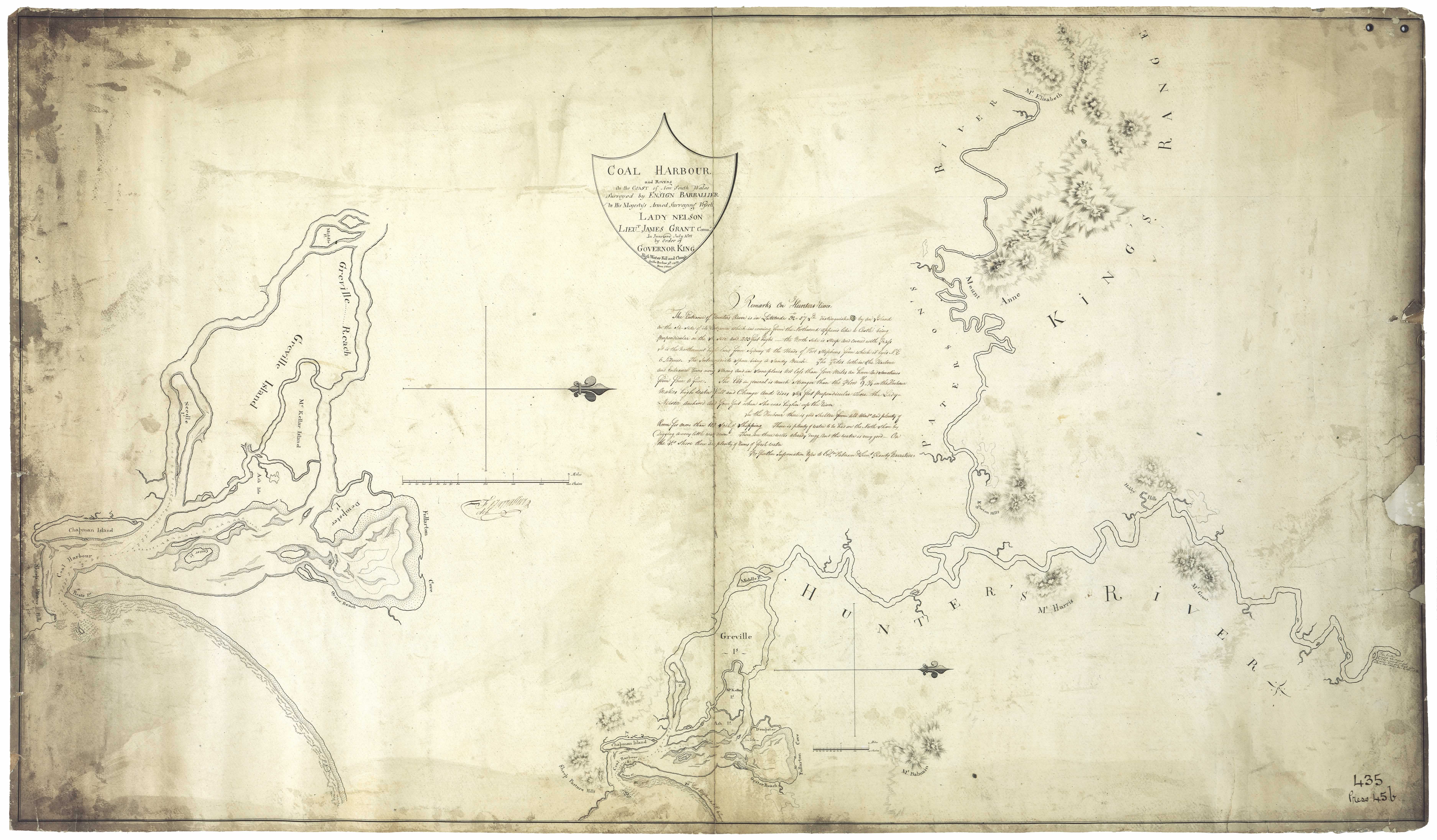
Chapman Island - Also known as Currumbah, Bullock Island, Onebygambah and Carrington. See Barrallier's 1801 map for location)
Charlestown - Suburb of Newcastle. Named by an early resident of French nationality desirous of immortalising one of the French Kings [46]
Cheapside House - Lewis Lipman's Clothing and Drapery Warehouse in Muswellbrook 1840's
Cheshunt - Land grant on the Hunter River to William Simms Bell, eldest son of Lieut. Archibald Bell.
Chevelly - Originally called the Duckhole and part of the Millers Forest area.
Chichester - Also Teachest (see Trove). River of NSW situated in Co. Gloucester; flows into the Williams River. Named after the Cathedral City in Sussex, England
Chilcott's Creek - Liverpool Plains
Church St. Newcastle - named after Christchurch which opened in 1821 [3]
Cintra - Grant to Susannah Matilda Ward- Paterson River
Circuit Flat - Co. Northumberland. Situated 15 miles S of Wollombi between Mounts Manning and Lockyer on the old North Road from Sydney to Maitland. [37]
Clan Alpine Cottage - Morpeth
Clardendon Park - Grant to Susannah Matilda Ward - Paterson River
Clarencetown - A town situated on the Williams River. Co. Durham. Aboriginal name Erringti (place of the black ducks)
Clerkness - district of New England. Station of Edward George Clerk
Clevedon - situated in Co. Durham near Gresford. Residence of Arthur Edwin Way in 1848
Cliffden Estate - Part of the estate of John Gault Smith at Woodville. In the 1860s this estate was purchased by Robert and John Graham. They developed one of the finest studs in the colony [43]
Cliff St. Newcastle - Named because it runs to the edge of the cliffs, overlooking the sea. [3]
Cliffdale - located at Wingen near Scone - estate of William Forsyth
Clifton House - located at Lochinvar
Clocides Bay - Co. Northumberland - an eastern arm of the harbour of Brisbane Water. Kincumber is situated in the eastern arm of this bay. [37]
Closeburne - Later Bishop's Court - Morpeth. Owned by Bishop Tyrrell from 1848.
Clydesdale - at Darlington. Occupied by John Johnston in 1833
Coalbrook - Early mining village in the Cardiff area
Coal Island - Early name for Nobbys Island. [31]
Coal River - Early name for Hunter's River
Cobark - Barrington Tops. Corruption of aboriginal work copang, the tree used by the aborigines to poison the water so as to stupify fish
Cobbitty - Creek in district of Liverpool Plains. On this creek is the station of D. Capel called Piedmont
Cobla - Situated near Tamworth on the Peel River
Cobrabald Mount. Co. Durham. Stands near the head of the Paterson River 3000 ft above sea level. [37]
Cobra Creek - Wyee Point
Cobre Bald (Mount) - Mount Royal Ranges
Cochrane Lake - Co. Northumberland. a small lagoon or inlet of the sea about 1 mile from Kincumber. [37]
Cock-a-Dingy - Previously known as Alnwick Estate near Raymond Terrace (1878)
Cockburn - River situated in district of Liverpool Plains; branch of the Peel River
Cocked Hat Creek - Early name for Edgeworth (prior to 1885). Named in honour of geologist William Tannatt Edgeworth David
Cockfighter Creek - So named in 1820 by John Howe and B. Singleton because one of their horses called Cockfighter was bogged here on their return trip from Wallis Plains (Maitland) to Patrick Plains (Singleton)
Cockle Creek - A stream in Co. Northumberland. Flows into Lake Macquarie. Named by Colonel William Paterson because of the numbers of cockles there [46]
Cockrabell - situated on eastern bank of the Krui river Co. Brisbane.
Cockrenoyo - Point of land near Carrington, Port Stephens
Codaget - Aboriginal Name. Dungog district. Also known as Quart Pot
Codagot Hill - near Tillegra (Teggs:1842)
Cockle Creek - bordering the estates of Weller and Ranclaud. Flows into Lake Macquarie (see Dixon's map)
Cogo - New England district. Station of A. Nivison
Colbin Farm - Upper Paterson
Collaroy (near Merriwa) - The long swamp reed; or junction or branch of creeks
Collier's Point - What is thought to be the first coal mine in the Southern Hemisphere was sunk at Colliers Point, below Fort Scratchley, in 1801
Collyblue- district of Liverpool Plains. Station of George Wyndham. Aboriginal meaning, a spring of water
Collymungle - district of Liverpool Plains. Greenaway's station
Collywarry - district of Liverpool Plains. Station of J. Cape
Colonel's Knob - Named after Col. Henry Dumaresq of St. Heliers Estate
Comboyne - aboriginal meaning a kangaroo
Combwell Farm - Paterson
Comleroi - Singleton district
Commonage - Public land bordering the Municipalities of Hamilton, Merewether, Lambton and Adamstown areas.
Como Como - district of Liverpool Plains, Pringle's station
Conadilly - River situated in district of Liverpool Plains. Flows into the Peel River at Mulluba Plains
Congewai - Cessnock district. Co. Northumberland 12 miles from Millfield. [37] Aboriginal meaning - many waters [46]
Congewai Creek - Rises below Myall Range 3km S.E. of Quorrobolong
Coogoowil - Kamilaroi aboriginal name for Piercefield [39]
Cookaboi - Station of J. Robinson, district of Liverpool Plains on the Bora Creek junction.
Cookapie - district of Liverpool Plains on the Namoi River. Station of Dr. Adams
Cook's Hill (suburb of Newcastle) - After Thomas Cook of Turanville near Scone. His parents retirement home Lucerna stood on the corner of Auckland and Laman streets
Coolabern Mount - Co. Northumberland. High peak in the Hunter Range on the S bank of the Wollombi Creek 2 miles from Wollombi. [37]
Coolah - W. Cassilis - Aboriginal meaning - the junction of creeks [46]
Coolawine Creek. Co. Northumberland. A small tributary of the Wollombi Brook. [37]
Cooley Camp A hilly area near 'Woodville'
Coolocoolo - near Caves Beach (W. Procter sketch 1841)
Coolongolook - (Coolingite) Co. Gloucester. 167 miles N of Sydney. Place of bats (Manning River Aboriginal name)
Cooloogooloogheit - Aboriginal name for East Maitland (1860s)
Cooma - district of Liverpool Plains. Doyle's station
Coomawidyera - Kamilaroi aboriginal name for Dartbrook
Coomoo Coomoo - W. Quirindi - Aboriginal meaning - wild gooseberries [46]
Coon Island - Swansea - named after Herbert Greta Heaney whose nickname was Coon. Read Ian Healey's history of Coon Island published in the Newcastle Morning Herald 18 September 1948
Coonanbarra - Aboriginal name for part of the Hunter River at Morpeth
Coongoolgon - (Aboriginal) Eckford's Lagoon near Morpeth
Coopabulga River - N. Cassilis - Aboriginal meaning - many high hills. The river rises in the Liverpool Ranges [46]
Coopernook - The elbow (that is, the bend in the river. Aboriginal name). Co. Macquarie. 209 miles N of Sydney. [37]
Coopabulga - Many high hills (aboriginal name)
Cooplacurripa - Aboriginal meaning - Plenty of Mosquitos. Cattle station 45 km north of Gloucester. Cooplacurripa Creek runs through the property
Cooranbong - From Aboriginal word 'Kour-an-bong' meaning rocky bottom creek or water over rocks. Lake Macquarie. Also Corrumbung. In Canon Streth's Toponomy the aboriginal meaning is given as a place of oak trees. The creek is lined with th dark belah or oak trees[46]
Coorumgoora - Kamilaroi aboriginal name for The Castle Rock, Muswellbrook district [39]
Cooreii Estate - Estate of Robert Lloyd Alison, Dungog. Aboriginal name for the high hill in the locality
Coorie Mount. Co. Durham. A high mountain about 1 mile to the E of Dungog. [37]
Cooreel (Kauraei) Hill in Dungog district.
Copacabana - E. Gosford - named after a beach at Rio de Janeiro, Brazil [46]
Copeland - W. Gloucester - named after place in Cumberland, England
Copper Point - early name for Vales Point
Coppymurrumbillah - district of Liverpool Plains on the Macintyre river. Station of John Browne.
Coquun - Aboriginal name for Hunter River
Corey's Nightcap - N. E. Tamwoth - a great block of white granite on the Moonbi Mountain under which Joseph King and Edward Gostwyck Cory spent a night in 1832 [46]
Corinda Estate - Situated five miles from Black Creek. Co. Northumberland. Estate of Archibald Bell. On Henry Dangar's map shown as Kurrundarra
Corlette - Port Stephens. Named after Captain Corlette of the cutter 'Lambton'
Corlette St. Newcastle. Named after James Corlette accountant or shipping manager A.A. Company in 1856.[3]
Cornwall Vale - Paterson
Corobeare - early name for Wollombi
Corrie Island - Port Stephens - aboriginal meaning cold water [46]
Corroba - also known as Garden Suburb. At Stockton. A ceremonial dance, a contraction of corroboree [46]
Coruna Cottage - Raymond Terrace
Cory Vale - Estate of John Cory, Paterson. Situated at the confluence of the Allyn and Paterson rivers
Corroba - A contraction of corroboree, a ceremonial dance
Corroborie Flat - Gloucester - aboriginal meaning - where the ceremonial dance is held
Corrumbah - located on Dangar's map in the Hunter River. Site of Bullock Island/Carrington. Adjacent to Cottage Creek
Cottage Creek Cemetery - Hunter Street Newcastle adjacent to the Palais Royale dance hall
Cotterill Lane - Highfields. Named for John Isaac Cotterill who made the first subdivision at Highfields in 1920 (Lake Macquarie History)
Coulson's Creek. Co. Brisbane. A tributary of the head of the Merriwa Creek. [37]
Coulston - Situated in Co. Durham near Gresford. Residence of J. Brown in 1848
Cow Hill Paddock - 2300 acres close to Lochinvar 1857
Cowmore - district of Liverpool Plains. Robertson's station
Crabbs Beach; also Flatrock - Swansea
Craigdarrech Estate - Williams River - estate of Robert Mackenzie 1835
Crangan Bay - Lake Macquarie
Cranky Corner Nature Reserve - North of the Hunter River at Dalwood; Approx 16 square miles [42]
Craven - S. Gloucester - named after an old A. A. Coy. shepherd known as Old Craven Jack, because he was always craving for more wages or a shift
Craven Creek. Co. Gloucester. A small northern tributary of Bowman's River. [37]
Crawford River- a river situated in Co. Gloucester. Branch of the Myall river.
Crawney Pass (Crawnie) - Nundle district
Crayton Shaw - Later known as Hillend. Upper Hunter. Estate of James Greig at Greig's Creek.
Cream of Tartar Creek. Co. Brisbane. A small western tributary of Harry's Creek. [37]
Creebank - Paterson. James Adair
Cressfield - Estate of Archibald Little - Co. Brisbane near Scone. Residence of S.H. Darby in 1848. Also known as Glencairn
Crippford Estate - County of Gloucester
Croki - Toad Fish
Cromarty Creek - named after William Cromarty - Port Stephens
Cromarty Bay - named after William Cromarty
Crooke's Park - Estate of John Hooke senior
Crossroads - Unofficial name of intersection at Cardiff Road and Edgeworth Road
Croudace Bay - named after Thomas Croudace manager of Scottish Australian Mining Company
Crui - river situated in Co. Bligh and Brisbane. Empties into the Goulburn river
Cryon - Name of run at Liverpool Plains belonging to Helenus Scott
Cubbaroo - district of Liverpool Plains on the Namoi River. Station of J. Button
Cuerindi - N. E. Manilla. Aboriginal meaning - a series of hills running steeply down to a river [46] George Hall's run on the Gwydir river
Culpa - Run belonging to William Ogilvie. Liverpool Plains
Cullarraba - Kamilaroi aboriginal name for Mt. Arthur (Whites Sugar loaf) [39]
Cullingral - deep waterhole
Cumbil - Run at Liverpool Plains taken up by Joseph Hyam
Cumboderryderry - district of Liverpool Plains. Station of W. and N. Lawson in 1848
Cumbrae Isle - Co. Gloucester. An island of the Myall Lakes. Called after the historic isles of that name in Scotland. [37]
Cumnaroy - old name for Jerry's Plains
Cumoo Cumoo - Run of Robert Pringle - Liverpool Plains Cundletown - Manning river aboriginal name Klundul
Cunningham's Gap - On the dividing range dividing the districts of Clarence River from Darling Downs.
Cureeki - Not obtainable
Currabubula - N. Quirindi - Aboriginal meaning - two forked trees or a bubbling spring [46]
Curracobakh - An open place
Curracabark - estate - Benjamin Hooke one of the original owners after the A.A. Co's occupation lease fell in. Woko National Park
Curracobundy - a deep valley through which the Barnard River runs. (aboriginal meaning narrow place or gorge)
Currindi - district of Liverpool Plains. Run taken up by George and Andrew Loder. Also Hall's station
Currungai - A creek in the district of Liverpool Plains
Curtis' Ridge - near Buckles Range.
Sources
Notes on the Origins and Locations of the Hunter Region has been derived from the following sources
[1] Trove - National Library of Australia
[2] Newcastle Morning Herald 11 December 1954
[3] The Newcastle Sun 2 May 1918
[4] The Newcastle Sun 26 January 1931
[5] The Many names of Newcastle Mulumbinba
[6] The Muswellbrook Chronicle 8 November 1899 ( native names of place from black tracker Jimmy of Muswellbrook)
[7] Lake Macquarie History of Places
[8] Cadell, F.A., Survey of Newcastle, Journal and Proceedings of the Royal Australian Historical Society, 1936
[9] Davies, Noel, Convict Nobbys : the story of the convict construction of Macquarie's Pier and the reconstruction of Nobbys Island
[10] Historical Roads of New South Wales
[11] Keith H. Clouten, Reid's mistake : the story of Lake Macquarie from its discovery until 1890
[12] County Electors in Newcastle 1855
[13] Hunter Estates Comparative Heritage Study
[14] The Dungog Chronicle 6 July 1949
[15] The Scone Advocate 24 July 1894 (Muswellbrook names)
[16] Wingham Chronicle 13 November 1931 (Manning River places)
[17] King Tom's Aboriginal Geography in Memorandum of E.C. Close, in Australian Town and Country Journal, 12 January 1878, p. 8.
[18] Aboriginal names, Australian Town and Country Journal 11 January 1879p. 17
[19] Henry Thomas Ebsworth papers, June 1825-February 1827; with illustration and maps
[20] Horsemen of the First Frontier (1788-1900) and the Serpent's Legacy Front Cover Keith Robert Binney
[21] An Australian Language as spoken by the Awabakal, the people of Awaba, Lake Macquarie, being an account of their language, traditions and customs - Lancelot Threlkeld (many of the aboriginal terms above have come from this source which is probably the language of the lower Hunter tribes)(many of the aboriginal terms above have come from this source which is probably the language of the lower Hunter tribes)
[22] Hunter Living Histories - Ludwig Leichhardt in Newcastle
[23] A geographical dictionary or gazetteer of the Australian colonies ... By William Henry Wells
[24] Placenames as a guide to language distribution in the Upper Hunter - Jim Wafer
[25] Lake Macquarie : past and present
[26] Wangi Wangi Street Names by Clive Read
[27] Forgotten place names of Lake Macquarie - Lake Macquarie Library online
[28] Lake Macquarie: Parish of Awaba, County of Northumberland, Shire of Lake Macquarie. Parish map in 4 sheets and reference sheet: South East Sheet
[29] Map of the Hunter River and its branches by Henry Dangar 1828
[30] Robert Dixon's 1837 Map - Trove
[31] Ensign Francis Barrallier's Map 1801 - Hunter Living Histories
[32] Australian Town and Country Journal 22 November 1873
[33] Procter's Sketch 1841 - Hunter Living Histories
[34] Tegg's Pocket Almanac
[35] Map of Young Wallsend (Edgeworth) showing Salty Creek Recreation Area, c.1920. Scanned from: Road and tourists' map of Lake Macquarie and environs, H. E. C. Robinson Limited, Sydney.
[36] Salty Creek Recreation Area
[37] Geographical Encyclopaedia of New South Wales
[38] Atlas of the settled counties of New South Wales - State Library NSW
[39] Maitland Weekly Mercury 4 July 1896
[40] Empire 3 Dec 1853 Lecture on the Kamilaroi Blacks (Rev. William Ridley)
[41) Israel's subdivision map of Wangi c. 1923. State Library of NSW
[42] Hunter 2000, National Trust of Australia (NSW), 1973
[43] Lauchland, E. S., Homes we Visited - Dumore. Newcastle & Hunter District Historical Society Journal, 1947 p. 39
[44] Boyle's Lower Hunter index, 1801-1883 (Harry Boyle)
[45] Hunter Valley Place Names and their Meanings, Newcastle Library, Archived 14 June 2011 at the Wayback Machine
[46] Toponomy: Place Names of New South Wales: Their Origin, Meaning and Locality, compiled by J. Carlos W. Stretch
[47] Rediscovering the Coquun: towards an environmental history of the Hunter River. Address given at the River Forum 2000 at Wyndham Estate, Hunter River; by Glenn Albrecht PhD, Senior Lecturer in Environmental Studies, The University of Newcastle
[48] How Many Inventors? Russell Rigby, Hunter Living Histories, 10 October 2017
↑